Sample Surveys
Boundary Surveys_1
Boundary Surveys_2
Boundary Surveys_3
PRA_Map 1
PRA_Multi Storey Floor Plan
PRA_Multi Storey Location Plan
Sample Boundary
|
Legal Surveys
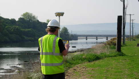
Laser Surveys have over 10 years experience in preparing legal maps primarily for registration in the PRA (Land Registry). We can prepare Maps for First Registration whether it’s for a suburban house and garden or an apartment in a Multi-Storey Registration or for a detached site. We also prepare maps of farms and lands which are also suitable for registration using digital Ordnance Survey maps and can supply Certified areas for these.
Where there is a boundary dispute Laser Surveys can advise on the best way to proceed. We will do a preliminary investigation and carry out an initial site inspection for a nominal fee. If in our opinion a full survey is required we will provide a quotation for preparing a full GPS Survey with research into record and archival documents as necessary.
We will carry out an accurate Land Survey and overlay this survey to your Deed Map. We will also show your neighbours Title Plan or Deed Map overlaid to our survey and these maps will show any encroachment into your property by a neighbour.
Where a boundary line is no longer evident on the ground we can retrace a lost or undefined boundary line from both Deed Maps and also from archival Ordnance Survey maps and field notes.
Where you require a boundary or subdivision line to be marked out on site we have all the necessary equipment and experience to precisely Set Out your boundary lines.
In the event that your boundary issues are to be settled by recourse to mediation/court, Laser Surveys can prepare an expert report and are happy to represent you in any litigation or arbitration proceedings. Where a Registered Boundary Agreement or Deed of Rectification is to be lodged with Land Registry (PRA), we can supply the necessary mapping.
For a nominal fee we can visit on site to discuss any boundary issues that you may have and provide an opinion on the best way to proceed.
We can also supply Certified Areas as required. These may be necessary where changes to a land holding have occurred or when submitting for registration to Land Registry. We can also provide maps suitable for submitting to Dept of Agriculture.
For Estate Agents we can supply Site for Sale maps with property outlined in red and can show site boundary outline on aerial photos. We can also determine exact site area from OS maps or from a new GPS survey. On the commercial side we can produce Net lettable Area maps for leases and can set out demise lines etc.
|